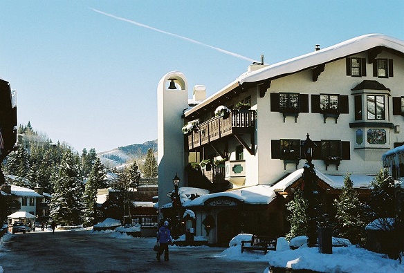
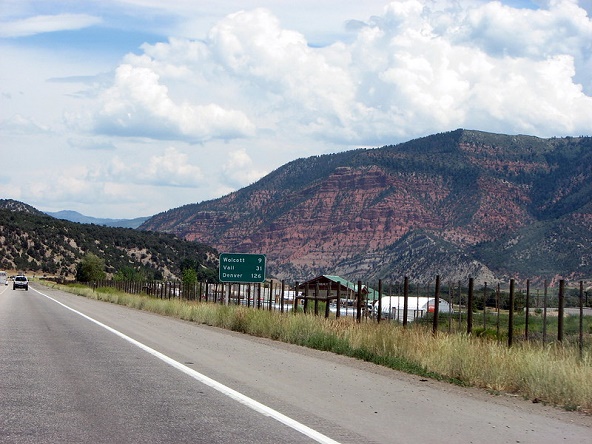
Internationally known Vail is famous for its skiing, European-like atmosphere and breathtaking views. Fortunately, it’s just a short drive from Grand Junction.
The alpine, luxurious vibe of Vail can seem a world away from often hot, dry Grand Junction, yet it’s only 149 miles (or 239 kilometers) from downtown Grand Junction to downtown Vail (the roundabout near Vail Village). Most of the time, it would take you around 2 hours and 20 minutes to drive there.

Of course, weather conditions can increase that time significantly. This includes the many snowstorms that can occur (usually from October all the way to May), and even mudslides, (or the threat of them), which can close down Glenwood Canyon for hours (or even days) at a time.
Either way, a 2 and 1/2 drive from Grand Junction to Vail is a good rule of thumb.
Drive Time and Directions from Grand Junction to Vail
The drive from the Grand Junction/Fruita/Palisade areas to Vail takes place entirely on Interstate 70. It has you driving through three different canyons and terrain ranging from desert to Alpine.
(On this map below, “A” is Grand Junction to Vail, “B”)
And other than the busier section of I-70 between Vail and Avon, you typically won’t experience a lot of traffic on this drive.
The slowest parts of the drive take place when driving through the canyons. The three canyons are De Beque Canyon (at the beginning of the drive to Vail), along with canyons on the east and west sides of Glenwood Springs.
Other than those curvy, slower sections, the route is wide-open, with two lanes in each direction. In particular the section from DeBeque to West Glenwood is typically sparse of lots of vehicles and flat, meaning it’s easy to accidently (or purposely) find yourself going way over the speed limit.
Glenwood Springs to Dotsero Leg
Grand Junction to Glenwood Springs is a little more than an hour drive.
After that, this section of the drive is the longest, as it has you driving through 18 miles of Glenwood Canyon. While very pretty, you won’t be pushing the needle to 75 miles per hour on this section. And, as mentioned earlier, there is always the chance that rainfall will close this section of I-70.
Past mudslides have closed this section for days on end, so the Colorado Department of Transportation isn’t shy about closing the interstate and re-directing traffic to a painfully longer route at even the possibility of a thunderstorm.
Dotserto to Vail
Once out of Glenwood Canyon, it’s relatively straight and flat the rest of the way, as you pass the small towns of Gypsum, Eagle, Wolcott, Edwards, Avon (which is the turn-off to Beaver Creek), then the short way onto to Vail.

Grand Junction to Beaver Creek Distance
It is 142 miles from Grand Junction to the base of Beaver Creek ski area. Even though Beaver Creek and Avon are closer west to Grand Junction, due to the fact Beaver Creek is located up a two-lane windy mountain road, the time it takes to get from Grand Junction to Beaver Creek Resort is 2 hours and 20 minutes, the exact same time it takes to get from Grand Junction to Vail.
As mentioned above, Avon is the turnoff to Beaver Creek and is just 17 miles from Vail. The turnoff from Avon up to Beaver Creek Resort takes about ten minutes on the winding Village Road. It is a pretty drive however.
Bus from Grand Junction to Vail
A Colorado-funded bus system called “The Bustang” can get you from four different places in Grand Junction to Vail – all in about 3 hours and 10 minutes.
This Bustang route from Grand Junction to Vail runs every day of the week, departing the Grand Junction Airport at 12:35 PM and 4 PM, and arriving at the downtown Vail Transportation Center at 3:45 PM and 7:10 PM respectively.
Prices as of this writing are $26 for a one-way ticket, but most-current tickets and prices are available here: Bustang Schedule
A second, more affordable, option is to take Greyhound, which has daily departures from downtown Grand Junction. Prices start at $17 for a one-way seat to Vail. Information available here: Greyhound Schedule
Flying from Grand Junction to Vail
Contrary to those cheesy websites written by bots or third-world freelance writers who have never stepped foot on Western Colorado soil, flying from Grand Junction to Vail is not a viable option.
(Related: Grand Junction to Denver)
First off, there aren’t any direct flights from GJT (Grand Junction’s airport) to Vail. This means you’d have to fly to Denver (most likely) for a connecting flight backtracking to Vail.
However even you are willing and able to pay that exorbitant fare, you’re still not landing anywhere close to Vail. The closest airport is Eagle County Regional Airport, in Gypsum – a 35 mile drive. It’ll take you 40 minutes to get from the Eagle County Regional Airport to Vail.
If landing at GJT and wanting to get to Vail, it’s much more convenient (and faster) to either rent a car or take one of the bus options.
(By Steve Beauregard. Photos courtesy of David Berkowitz and dianaoftripoli via Flickr).
