It’s 312 miles (or 502 kilometers) from Grand Junction to Colorado Springs when driving on Interstates 70 and 25. It takes just over 5 hours under normal driving conditions.
This interstate drive is the fastest way, but not the shortest. (More on this below). That’s because there are actually two ways drive there, a northern route and southern route.

Grand Junction is on the far western side of Colorado, with Colorado Springs in the middle of the state. As the crow flies, it’s less than 200 miles between the two cities. Unfortunately, there isn’t a straight shot to Colorado Springs from Grand Junction. Then there’s the fact the towns are separated by the Continental Divide.
All of which is to say, you have to drive a little out-of-the-way to get to Colorado Springs. The two main, fastest routes are (1) Interstate 70, and (2) US Highway 50.
Grand Junction to Colorado Springs Drive
(1) Interstate 70
This route is 312 miles and would take you 5 hours and 4 minutes to drive, per Google Maps. I’ve driven this many times and that seems about right.
Other than a few miles on a beltway shortcut on the outskirts of Denver, this drive takes place entirely on two different interstates: I-70 east and I-25 south.
Grand Junction to Glenwood Springs is the first leg of this trip, (a little over an hour in lenght), and the least scenic.
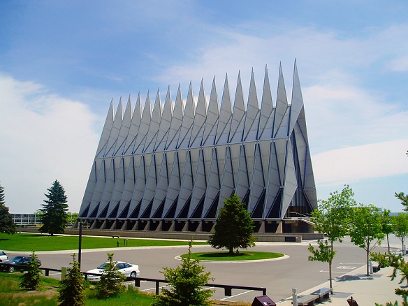
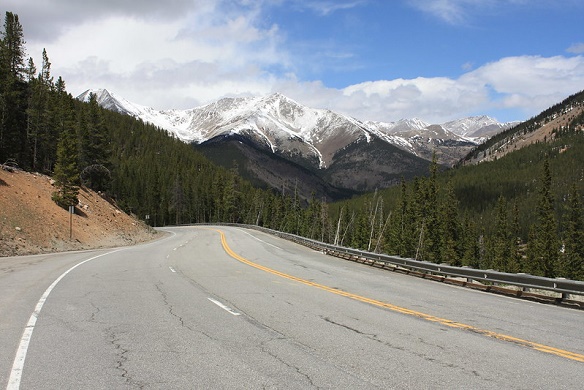
But from there, the drive offers a lot of variety. You’ll see everything from deserts to outlet malls, exotic ski resorts, to a United States Service academy and more. You start with desert terrain, traverse through several canyons, cruise past Beaver Creek and Vail ski areas, before ascending up to just over 11,000 feet above sea level.
After exiting the 1.6 mile long Eisenhower-Johnson Tunnel at over 11,000 feet you’ll experience a long descent down to the western edge of Denver, where the C-470 beltway acts as a shortcut between Interstate 70 and I-25.

The drive from Grand Junction to Denver takes a little over four hours. Once on Interstate 25 at Denver, you’ll typically experience a decent amount of traffic. The drive on I-25 will have you passing by Castle Rock, and the Air Force Academy, which is just a few miles north of Colorado Springs. Denver to Colorado Springs is roughly an hour’s drive.
(2) US Highway 50
This southern route is 295 miles and takes 5 hours and 28 minutes per Google Maps. This also seems accurate when driving with decent weather.
At 295 miles, this is shorter route by a few miles. However being only a two-lane road in many places, it takes longer than the smoother interstate drives listed above. This drive takes roughly 5 hours and 30 minutes under normal conditions.
As pretty as Interstate 70 can be, this is the more charming, more scenic route.

It’s less stressful, with less traffic, and you get to experience a more rural Colorado vibe.
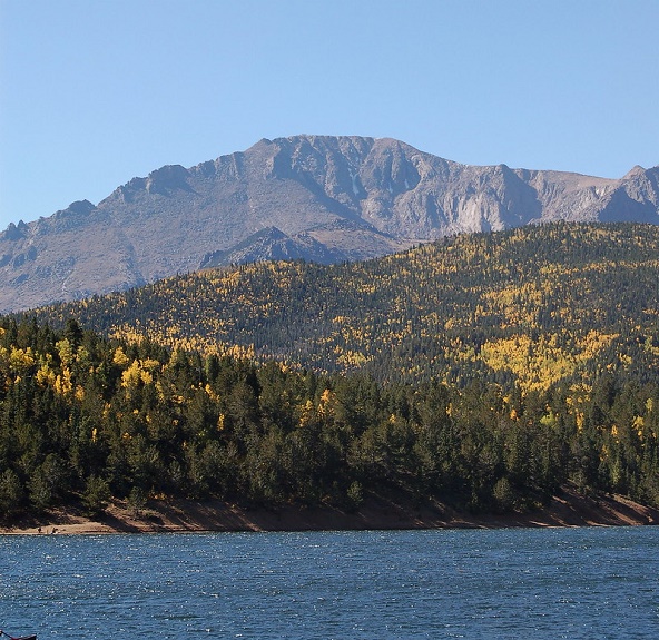
You drive past National Parks (Black Canyon National Park), lakes, forests, National Monuments, and even Pike’s Peak!
You start off on Highway 50, going through the flatter, desert section to Delta, Colorado, then onto Montrose.
Just 8 miles outside Montrose is the entrance to the gorgeous Black Canyon of the Gunnison National Park.
This stretch from Montrose to Gunnison is pretty, but is slower-paced, with a winding, two-land road going over mountains, and through canyons, before transporting you along the banks of Blue Mesa Reservoir.
After passing through Gunnison, summiting Monarch Pass, then descending onto the small town of Poncha Springs, you head due north, on Highway 285, on a relatively flat and straight stretch.
Just before reaching the town of Buena Vista, you’ll make the turnoff on Highway 24 east. It’s almost entirely a two lane road from here on out, but the gorgeous wide-open vistas are worth it.

As you get closer to Colorado Springs, imposing Pikes Peak appears on your right. The highway becomes four-lanes and traffic picks up as well.
The descent down to Colorado Springs has you driving past a fun little, charming amusement park called Santa’s Workshop. You won’t find thrill rides here, but my kids (both under 7 at the time), enjoyed it.
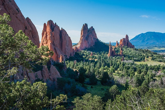
From there, Cave of the Winds park, Garden of the Gods, and the cute town of Manitou Springs fight for your attention (and dollars) before you reach the outskirts of Colorado Springs.
Without factoring in stops, 5 1/2 hours for this drive is a good rule-of-thumb.
Weather from Grand Junction to Colorado Springs
A visit to your favorite weather website, or to the Colorado Department of Transportation’s road conditions page here: CDOT, is in order if driving from Grand Junction to Colorado Springs during the snow season – which is usually October to May.
This is true whichever route you take, however pay particular attention to the Highway 50 southern route weather. With much less traffic and not being an interstate, it’s natural for there to be fewer transportation snow removal resources to be devoted to this section. And with the top of Monarch Pass being over 11,300 feet above sea level, you do not want to be crossing this during a heavy snowstorm.
(Related: Distance from Grand Junction to Vail)
Bus from Grand Junction to Colorado Springs
You could, technically, take a bus from Grand Junction to Colorado Springs, in the same way you could, “technically” walk there.
Although there are two major bus systems in Colorado (Greyhound and the state’s Bustang system), there isn’t a direct bus route between the cities.
Either way, you have to bus to Denver, then transfer in a marathon-long day. It’s actually more than a marathon. Greyhound, for example, advertises the trip taking 8 1/2 hours.
Grand Junction to Colorado Springs Flights
There aren’t any direct flights from GJT (Grand Junction Regional Airport) to COS (Colorado Springs Airport). This means you’re stuck flying to Denver, then waiting in a layover before taking your very short connecting flight to Colorado Springs.
Between the high ticket prices and connecting hassles, flying from Grand Junction to Colorado Springs isn’t worth it in most cases (in my opinion).
(By Steve Beauregard. Photos courtesy of Phil, David, Lee Coursey and David Herrera via Flickr).
